Liquefaction Assessment
Ground liquefaction occurs when loosely packed, water-logged soils lose strength as result of an earthquake. Liquefaction causes ground to sink, move laterally and create ejecta. The results of liquefaction to buildings and infrastructure can be catastrophic. New Zealand’s Christchurch earthquake (2011) showed New Zealanders what the effects of earthquake induced liquefaction can do. An estimated 400,000 tonnes of material (silts/sands) pushed up and altered the ground surface across the city.
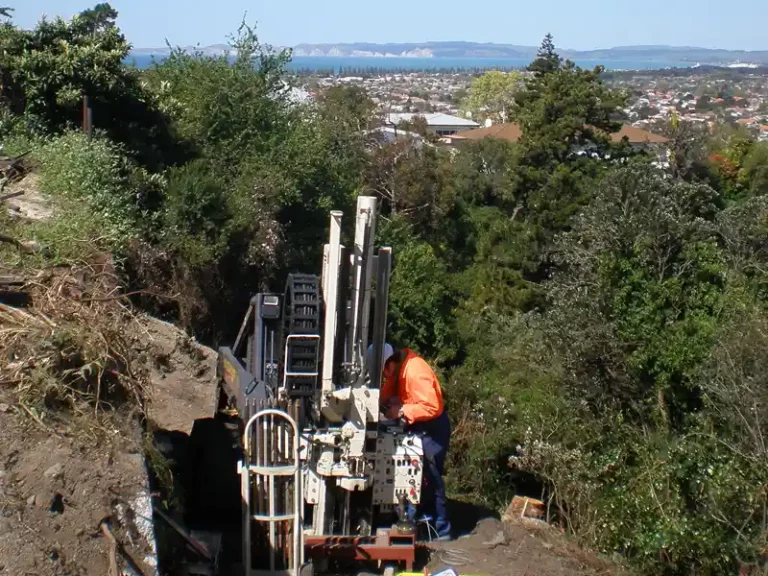
RDCL undertakes liquefaction assessments by testing the ground and ground water tables and modelling the effects of earthquake induced shaking. Lateral spread and vertical settlement are two of the key outputs from such assessments.
Assessing liquefaction for geotechnical engineering is most often completed using Cone Penetrometer Testing (CPT). Seismic surveys (MASW) can also provide shear wave velocity liquefaction models.
Today across many councils in New Zealand, building consents require detailed liquefaction assessments and published maps of at risk areas are found online within councils’ hazard portals.
Several such portals are linked below;